
River Maps
The Whitehorse River Map project started after a couple of incidents on trips. We found that there was a need for maps that showed where the rapids were, where the hazards were and how to access the river, particularly any emergency access points. Topography maps didn’t show the information we needed and usually didn’t match the river sections we paddled. We decided to create our own river maps.
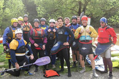
It took longer than we expected and lots of people were involved along the way, including a large number of past and present club members together with the 2002 final year students in Cartography and Multimedia Cartography at RMIT.
In recent years, Whitehorse has partnered with Robert Springer from Melbourne University Mountaineering Club to produce new maps and update old maps.
The purpose of the maps is to assist paddlers to paddle rivers safety. Paddling is inherently dangerous and rivers change due to floods, rock falls etc. You should rely on your own ability to assess rapids and river hazards.
A lot of time and effort have gone into these maps but we think it is important to get them out there so we've put them on our website for you to download.
We would appreciate any feedback so we can keep the maps up to date. Also we are planning to include new Victorian rivers so if you are interested in assisting in creating the maps please contact us.
E-mail maps@whitehorsecanoeclub.com for map enquiries and feedback.
Back ground info and key
River Maps
Disclaimer
You have to promise not to sue us over these maps. We are not for profit, doing this for the love of it, all care and no responsibility. Besides, we have no money anyway.
There's a chance that some of the info is wrong or out of date, rivers do change their features.
Do not rely on the maps as your only source of information and they are certainly no substitute for personal knowledge and experience of a river.
Whitewater paddling is an adventure sport which carries with it inherent risks, you have to take responsibility for your own decisions and welfare.
If that hasn't put you off then enjoy your paddling.
Join the Whitehorse Canoe Club and help contribute to the paddling community.
Downloads
The maps have been designed to print into an A3 size booklet if so desired.
We have left them this way to be able to laminate each map to take along and mark-ups can be added with a chinagraph pencil.
Obviously, any corrections are gratefully accepted, and GPS co-ordinates would be a welcome addition for newer versions.
River Maps with your river location on Avenza Maps
Paper or digital contour maps are excellent for trip planning and by using a compass and terrain features you can establish your position on a river.
However, as you know, in narrow valleys and winding rivers with rapids that are close together it can be difficult and time-consuming to know with confidence, and accuracy, the distance to the next river feature.
In the event that it is necessary to walk out from a river selecting the correct spur and knowing how far you are from a fire trail or access point can also be difficult.
To improve enjoyment and safety Whitehorse has commenced a program to create georeferenced PDF river maps.
A georeferenced PDF file is a type of PDF document that includes spatial information, linking the map or image within the file to real-world coordinates. This enables the map to be used in geographic information systems (GIS) or mapping software, as the locations on the map can be accurately aligned with the Earth's surface.
Here’s how it works:
- Georeferencing means embedding geographic coordinates (latitude, longitude, or other coordinate systems) into the file. These coordinates are usually linked to specific points on the map or image.
- A PDF (Portable Document Format) is used to display the map or image, but in a georeferenced PDF, it also includes metadata or hidden data that ties the map image to real-world locations.
By using a georeferenced PDF, a paddler can load the map into a GPS-enabled device or app, and it will align correctly with the landscape as the user moves, helping them orient themselves in real time.
Importantly, the georeferenced pdf can be downloaded to a device and stored before you leave home, and mobile phone coverage is not needed to view the map.
In simple terms you have a blue dot on the map that tells you where you are on the river or up the hill if you have to walk out.
To display and read Georeferenced PDF maps you need to import the file into an App on your smart phone or tablet.
Whitehorse maps are free and available from the Avenza Maps App which can be downloaded from the Apple or Android App Store.
Avenza Maps is used by the National Parks Service in each Australian state and many other organisations to distribute their free maps for viewing.
Avenza has a number of subscription plans.
Avenza “Free” is free with the limitation that you can have no more than 3 maps on the device at any one time. Upgrading to a paid version provides more maps on your device and more mapping features however to look at a Whitehorse River Map and see your location you need only the free version of Avenza.
The Avenza site has a large Support section and there are Tutorial videos on YouTube.
Research Avenza and make sure you are comfortable using the App before you leave home and keep your battery charged and your smart phone dry!!!
It is important to also carry a paper map and compass.
Remember that the Compass Apps on smart phones typically require some movement over the Earth’s surface to work accurately. If you stop and pull out your phone from a waterproof bag inside your boat without moving it may not point to North until you start moving so always check it against an old-fashioned magnetic compass.
You can find the WHCC Maps on the Avenza store for free.